Elevation
Advertisement
Prog Finder v.2 29
Prog Finder - Ex. Prog Satellite Finder. Simple and completely free the utility capable considerably to help with adjustment of the Satellite dish or Terristeral antenna. Main features: - Calculation of azimuth and elevation angle.
Advertisement
Mkon's SatCalc v.0.5
SatCalc is a free software which calculates Azimuth and Elevation for geostationary satellites used for television broadcast. Features include the calculation of the LNB skew and calculation of sun outage which occurs in spring and fall.
RackTools v.3 5
RackTools® software increases the efficiency of your business by allowing engineers and salespeople to quickly and easily specify Middle Atlantic Products, and create accurate rack elevation, plan, side and rear view drawings, purchase orders, and q
DXF2XYZ v.2.0
DXF2XYZ converts a DXF file to an XYZ file, ie a comma delimited text file containing just xyz coordinates. It can be useful for extracting the raw XYZ coordinates from a DXF file containing say contours or other elevation entities.
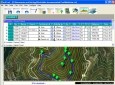
Garmin BaseCamp v.3. 2. 2002
Take charge of your next adventure with BaseCamp, software to view and organize your maps, waypoints, routes, and tracks and send them to your Garmin device. Main Features: -View 24K or 100K topographic maps and other topographic data.
AutoDEM
AutoDEM (aka as AutoMNT) is a freeware GIS software to create Digital Elevation Models (DEM) from scanned topographic maps for Windows. Through different data layers (map, contours, DEM, etc.
SatCalc v.1 2
You can enter your City/State OR Zipcode and it outputs a lot of useful information like Azimuth, Elevation, Latitude, Longitude, and Magnetic Deviation.
Astro Helper v.0.0.1 beta
Astro Helper will tell you the angle of elevation above the horizon (altitude) and the direction in degrees from North (Azimuth) of the selected objects.
Base Camp v.3. 2. 2002
Take charge of your next adventure with BaseCamp, software to view and organize your maps, waypoints, routes, and tracks and send them to your Garmin device.
EMapZone v.4.5.0.3
- Prepare a trip on any map from a scanner - Obtain total distances and elevations in a flash (some altitudes have to be set) - Print a personalized map at any scale for terrain use - Print the elevation curve at the required scale
Milestone Simulator v.1.0
Milestone Simulator is a software to visualise multi-storeyed building projects during the planning stage, simply from its elevation picture. Milestone simulator is not suitable to monitor project progress during execution.